Itinerary
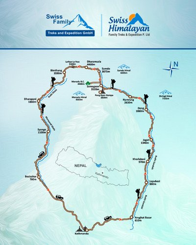
Day 01: Drive from Kathmandu to Machha Khola (870 m/2657 ft) via Arughat Bazar by private vehicle (6-7 hours)
Early in the morning after breakfast at your hotel, we will pick you up and we drive to Machha Khola via Arughat which takes about 6-7 hours by private vehicle. Your will be enjoying with views of teracced fields and villages during the drive. Also, we will stop for lunch on the way. Stay overnight at a lodge in Machha Khola.
Day 02: Trek from Machha Khola to Jagat (1340 m/4396 ft, 14 km/8.2 mi, 6-7 hours)
Continue up and down over a couple of ridges to Tatopani (930m; ‘hot water’) where there are hot water spouts under the sheer cliffs that provide a delightful evening shower. Climb over a ridge and cross the Buri Gandaki on a rickety suspension bridge, climb on well made marble stairs in the narrow valley for some time and through Doban (1000m; Duvan). Shyaule Bhatti 1hr later has large rock with views where you can take tea and look at the wild gorges ahead. After crossing a landslip and the bridge across the Yaru Khola (1363m), emerge onto river flats for lunch at Yaru (1140m) at the Sandbar Hotel. Look downstream at the massive rock fall that chokes the river. Just past Yaru, cross to the left bank and enjoy easy up and down to Jagat (1410m), a neatly Flag stoned Gurung village where Jagat (‘tax’) is collected on Tibetan trade. There’s a small lodge here and you will need to show your MCAP permit. In this area, potato, maize and climbing beans are all planted at the same time — the potato for food and to suppress weeds, the maize for food and to supply a trellis for the beans, which are an important source of protein. Marijuana is a major weed problem. Stay overnight at a lodge in Jagat.
Day 03: Trek from Jagat to Deng (1860 m/6102 ft, 20 km/12.4 mi, 5-6 hours)
Walk up the riverbed then climb over a rocky ridge to Salleri (1440m) with views of Sringi Himal (7187m), then descend to Sirdibas (1430m; Setibas, Tara) where there is said to be a lodge. You’ll see your first signs of Buddhist culture here. Continue up-river on the left bank, up and down before crossing Nepal’s longest suspension bridge to the east bank and a tiring climb up to prosperous Philim (1590m; Dodang) surrounded by rich fields of maize, potato and millet. Traverse north out of Philim on the obvious track signposted to the Larkya-La, through some pretty forest with views up the narrowing valley. After 1hr climbing enter the increasingly misnamed Ekle Bhatti (1600m; ‘lone teashop’) with at least six bhatti, then traverse high above a spectacular gorge, entering a largely uninhabited area of pine trees. Eventually drop to a trail junction going left to Ghap and right to the Tsum Valley. Cross the Buri Gandaki on a solid bridge and traverse to a welcome bhatti just around the corner for tea and a last look up the Tsum Valley. Enter a very narrow gorge with loose tracks, up and down, up and down. Cross to the east bank (true left) at one point and then back again to the west bank on a sloping suspension bridge. Enter Nupri (‘the western mountains’) through bamboo forests to Deng (1800m), inhabited by Gurungs who practice Buddhism. Stay overnight at a lodge in Deng.
Day 04: Trek from Deng to Namrung (2630 m/8629 ft, 17 km/10.6 mi, 5-6 hours)
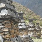
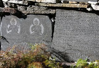
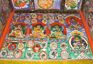
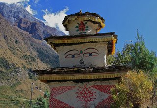
Just beyond Deng re-cross to the east bank and climb to Rana (1980m) and pass the trail up to Bhi (2130m; Bihi). The river roars below except one place where a rock fall has created a huge dam. Continue in and out of canyons, cross the Serang Khola coming from the north and climb steeply again before finally circling into Ghap (2160m; Tsak). The mani walls here and onwards as far as Bimtang often display intricate quality carvings of various Buddhas in meditation, incised in the hard local stone by a family of carvers from Bhi. There is a good classic lodge as you enter Ghap on the left and the Kyima Lodge still under construction further through town across the bridge, on the right and good camping ground A side-trip from a bridge below Bhi can take you up to Prok (2380m), with an ACAP office and emergency radio and an excursion to Kal Tal (3685m; Kalchhuman Lake), then back down to Ghap (according to Lonely Planet). Enter a beautiful forest of fir and rhododendron with many birds, staying on the south bank, cross north on a wooden bridge with a roaring narrow canyon below then cross back to the south bank on a second wooden bridge with grey langurs watching. The main trail now climbs on well-made stairs, but a shortcut to the right just after the bridge and along the riverbank is far quicker and through superb pine forest. Arrive in the neat village of Namrung (2660m) after about 1.5hrs from Ghap, with shops, a restaurant and the Thakali Lodge across the flag stoned square. While staying there it is worth wandering around the village, where carvings from Bhi have been painted in colors above a gateway. The architecture characteristic of upper Nupri starts here: several houses gathered together about a common courtyard and livestock shelters on the ground floor, with heavy wooden shingle roofs and log stairs to dark verandahs. Stay overnight at a lodge in Namrung.
Day 05: Trek from Namrung to Samagaon (3520 m/11549 ft, 17 km/10.6 mi, 6-7 hours)
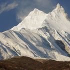
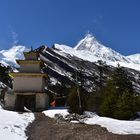
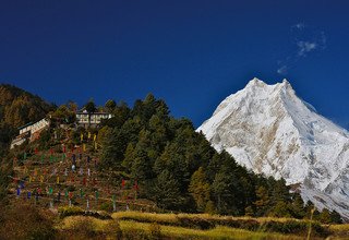
Pass mani walls, fields and houses and enter the fir, rhododendron and oak forest before climbing to Li (2900m; Lihi, Ligaon) in 45mins, then onto Sho (2950m, Syogoan) where there is a bhatti. The platforms in the fields are where people keep overnight watches to chase bears from their crops. Most people from here onwards wear traditional Tibetan dress, with the children in small chubas like dressing gowns, asking for shim shim (Tibetan for candy). There are some particularly fine paintings in the kani (gate arches) that you pass under before Sho. A leisurely walks onwards, in and out of gullies to Lo (3180m; Logoan). Pity about the wedding-cake stupa donated from Taiwan which dominates this otherwise picturesque village focused on yak herding. There are excellent views of Manaslu (8163m) and Manaslu North (7157m) from the mani wall at the far end of the village and from the gompa on the hill to the west, worth the walk up. This long day takes you into the mountains with time to enjoy and acclimatize. Easy walk to Syala (3520m, Syalagaon, Shyaula) up a pine and rhododendron gully with moss and gin clear stream. Enjoy 360° views from here due to a fire and extensive deforestation. Another easy hour to the large village of Sama (3530m, Samagaon, Ro), losing the gigantic views of Manaslu but entering a world of yaks, pastures and houses which seem to have grown from the stones. Only potatoes and barley can be grown at this altitude. Stay overnight at a lodge in Samagaon.
Day 06: Acclimatization day. Hiking to Manaslu Base Camp (4400 m/14336 ft, 14.2 km/8.8 mi, 8 hours and back )
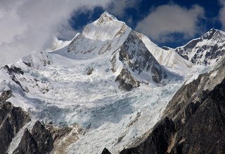
This day is set for you to rest and get adjusted to the high altitude. There are various places to visit in Samagaon like Birendra Tal or Anie Gompa. Afterward, the team will hike up to Manaslu Base Camp. From the base camp, you get a wonderful view of Mt Manaslu (8156m). After spending some time at the base camp, you return back to Samagaon for the overnight stay. Stay overnight at a lodge in Samagaon.
Day 07: Trek from Samagaon to Samdo (3875 m/12713 ft, 8.2 km/5.1 mi, 3-4 hours)
Another short day because of the altitude, with time to go via the iceberg-covered Birendra Tal (3450m) under the Manaslu Glacier, wade the exit stream depending on the time of year and drop down to pick up the main trail from Sama to Samdo. Easy walking through yak pastures up a broad valley with long mani walls, marmots in all directions standing on their burrows. Finally leave the tree line behind, although low-lying juniper is all around, climbing to a ridge and drop to cross the Buri Gandaki on a wooden bridge. It takes some time to reach the white kani above but immediately behind is Samdo (3860m), a very picturesque village dedicated to yak herding, so much so that there are more animal and fodder shelters than human accommodation. Side valleys and Samdo Peak call out for afternoon wandering but take a jacket as cold wind can come up at any time. You can see the main track for Tibet over the Lajyang La (Lajyung Bhanjyang, (5098m) sloping up the right hand valley. The Larkya-La trail is ahead and left. The track to Tibet is currently closed but stocks of timber are being carried up to Samdo by yak in expectation of resumption of trade. The nearest Tibetan town is only one day away and there is Chinese and Tibetan beer and food for sale in Samdo. Stay overnight at Lodge in Samdo.
Day 08: Trek from Samdo to Dharamsala (4460 m/14633 ft, 6.1 km/3.8 mi, 3-4 hours)
Descend beyond Samdo on a broad trail, dropping to cross the much-reduced Buri Gandaki at 3850m. Pass another trail to Tibet to the right and climb left after a mani wall, traversing through juniper with many marmots. Cross two ravines on narrow tracks. There is no Larke Bazar despite what many maps assert; at one time traders from Namche Bazar came through Tibet to trade in this area and maybe some of the scattered stone shelters you will pass were part of that market. Dharamsala (4480m; Larke Phedi, Larkya Resthouse) is a stone hut with three rooms and an almost intact roof, but the lack of doors means that it can fill up with snow and remain full of ice for months. Don’t count on it for shelter: carry a tent. The views are marvelous. A large herd of blue sheep call the tussock-covered hills home. Stay overnight at a lodge in Dharmasala.
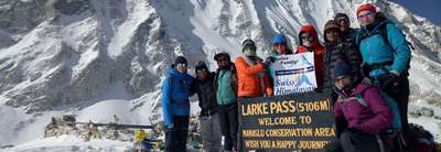
Day 09: Trek from Dharamsala to Bimtang (3590 m/11778 ft, 14 km/8.7 mi, 8-9 hours) via Larkya-La Pass (5160 m/16929 ft)
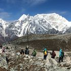
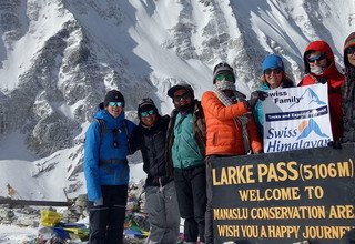
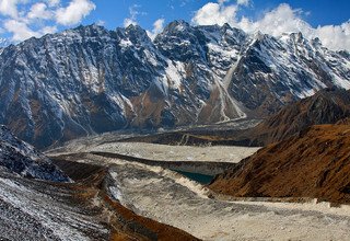
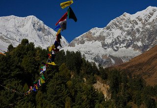
Climb steadily over the ridge behind Dharamsala and beside the large lateral moraine of the Larke Glacier. The climb is not difficult but it is long and rocky underfoot, particularly as you top the moraine. Look for cairns and metal snow poles which assist route finding. Descend past four frozen lakes and make a final tiring climb to the left up to Larkya-La (5100m), marked by prayer flags. It takes about 3-5hrs to reach the pass and it can be very cold and windy with a risk of exposure if under-equipped or ill. The peaks to the west are Himlung (7126m) near Tibet and Kang Guru (6981 and Annapurna II (7937m) in the Annapurna Range. Descend over the moraine to the west, on the right side of a deep gully, and then drop steeply on loose screed, eventually traversing left on steeper screed. There are several places where snow or ice would make this treacherous and some groups fix a rope on the steepest piece. Make a long descent on loose gravel to a welcome more level area with grassy moraine, where the angle eases. The track now runs left of the large lateral moraine, rocky at times, in a widening and beautiful valley all the long way to very scenic Bimtang (3720m; ‘plain of sand’), a descent of 1400m in about 3hrs. The views during the descent are huge — icefalls and mountains in all directions, a medial glacial lake (Pongkar Tal) between the Pongkar and Salpudanda Glaciers, and the joining of these two glaciers with a third glacier to form the Bhimdang Glacier whose lateral moraine towers over Bimtang. Stay overnight at a lodge in Bimtang.
Day 10: Trek from Bimtang to Dharapani (1860 m/6102 ft, 25 km/15.5 mi, 8-9 hours)
Climb above Bimtang on the lateral moraine, walk south along the crest to find a route down the moraine wall and cross the Bhimdang Glacier, which can be loose underfoot. Climb up the far moraine wall quickly to avoid stone-fall and enter some of the best forest in Nepal. If you are in rhododendron season, the mauves, reds, pinks and whites are stunning amongst the huge pines. The views of the back of Mt Manaslu are equally stunning. Descend rapidly along the true right bank of the aptly named Dudh (‘milk’) Khola through a bhatti at Hompuk (3420m) in a forest clearing. Gentle riverside walking continues rapidly to Karche (2700m; Karache) for morning tea after about 3.5hrs. In the next hour you will see many signs of flood, with tree trunks smashed and banks undermined, the track becoming quite rough. Climb steeply over a ridge and drop to Gurung Gho (2560m), the first real village since Samdo. There are two lodges here, the second being comfortable for overnight, or lunch if continuing. The valley becomes more agricultural as you pass fields and copses of oak and rhododendron, staying on the north (true right) bank until Tilje (2300m; Tiljet). The Larke Pass Hotel offers beds and a dining room. Pass under a stone arch, cross the Dudh Khola and descend rapidly towards the Marsyangdi Valley through scrubby forest. Cross back to the north bank just below Thonje (1900m;Thangjet, Thoche) and climb up to join the main round-Annapurna trail, over the Marsyangdi Khola on a long suspension bridge. Turn left into Dharapani (1860m) and take a good camping ground spread down the hill. Stay overnight at a lodge in Dharapani.
Day 11: Trek from Dharapani to Jagat (1400 m/3609 ft, 17.9 km/11.9 mi, 5-6 hours)
Climb down along the Marsyangdi River, first cross by an iron bridge just end of the Dharapani village. Then, continue up stream of Marsyangdi Riveruntil reaching Kotro and cross by a long suspension bridge over the Marsyangdi River. The trail continues right hand through the small battis in the canyon. There is again other suspension bridge, cross over the bridge and drop down to sandy area near the Tal village. After Tal, the trail drop down to the River in rocky trail and climb up the through the dense forest area and again cross by a suspension bridge near the Chyamje where lunch break. Then, the trail continues in the left hand until reaching Jagat Village. Stay overnight at a lodge in Jagat.
Day 12: Drive from Jagat to Kathmandu 6-7 hours by private vehicle
Morning, after packed all the equipments and upload to the Jeep and drive back to Kathmandu passing beautiful landscapes and picturesque villages and it takes about 6-7 hours. The views of mountains are spectacular during the driving and transfer to your own booking hotel in Kathmandu. Our service ends here!
# Pricing for Group Size Basis: (Private Trip)
All-inclusive Trek Price for single/individual trekker; USD 2005
All-inclusive Trek Price for 2 trekkers basis; USD 1335 per person
All-inclusive Trek Price for 3 trekkers basis; USD 1240 per person
All-inclusive Trek Price for 4 trekkers basis; USD 1145 per person
# Pricing for Group Size Basis: (Group Joining Trip - Min. 4 persons and Max. 8 persons)
All-inclusive Group Joining Trek Price; USD 1145 per person
Please choose your best suited date and join with us on Around Manaslu Group Trek in 2026/2027.
Note: This is a general itinerary, which can always individually be “tailormade”. The trek package can be redesigned or redeveloped as per your taste, For more information please e-mail us at snftnepal@yahoo.de
Important: In case of emergency during the trip, Helicopter will be arranged by Swiss Himalayan Family Treks and Expedition Pvt. Ltd. The charges must be paid by the clients themselves.
